 Underwater 3D Animation for Divers
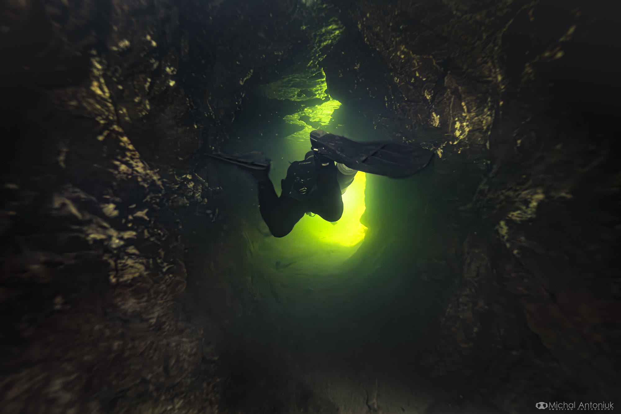
Inside the flooded tunnel under Srebrna Góra Fortress.
A Submerged Foundation project in the wells of an 18th-century mountain fortress in Poland: a flooded tunnel we dived, lost a robot in, pumped dry and scanned.
Agentic coding lets me take an idea all the way to where I want it to be.
Over the years I've collected a lot of scans: flooded mines, wells, wrecks. Most of them were too big to show as they are. A full scan is millions of triangles and hundreds of texture images, and almost nothing on the web will open that.
So people saw renders. Or videos. Or optimised chunks on Sketchfab.
I'd wanted to fix that for a long time, and I knew how it should work. Nexus tiling, so the model streams in small pieces. Loading optimisations, so the browser only fetches what's on screen, at the detail the screen can show. Interactive hotspots with photos and videos. Navigation that works on a phone. I had it all designed and drafted out.
Without agentic coding, building it would have taken months and hundreds of thousands of dollars. With it, I built the viewer this year. You open a link and fly through the place. It loads the part you're looking at and sharpens it as you get closer.
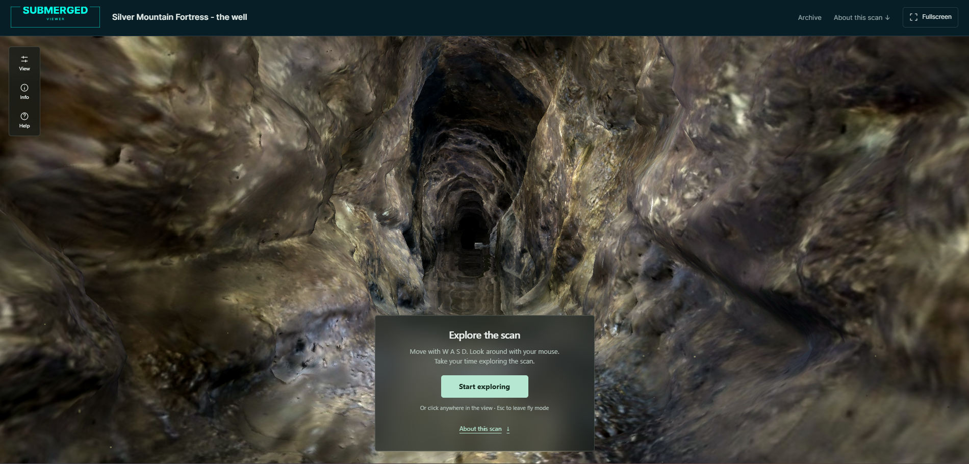
The first story I want to tell with it is a Submerged Foundation project I led: the wells of Srebrna Góra Fortress in Poland.
Go inside the Srebrna Góra well scan
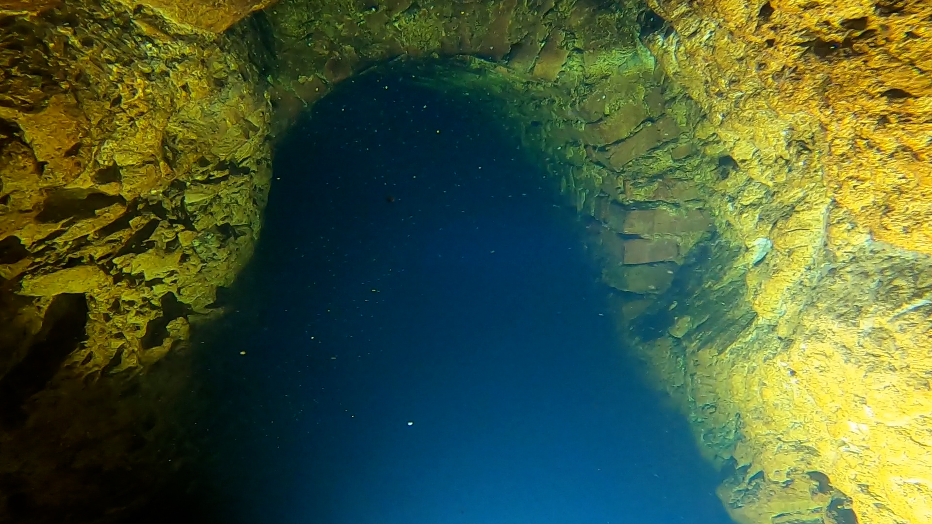
Mid-dive, in a tunnel that won't end
This tunnel is long, I thought. It was supposed to be a few dozen metres. It doesn't want to end.
I hadn't brought a marked line, so I had no idea how far I'd swum. The passage is tight and flooded, and every exhale brings a cloud of silt down from the ceiling. It's like diving inside a snow globe that someone keeps shaking.
I'm too wide anyway. My drysuit scrapes both walls. The way back will be by touch. In visibility like this your eyes only get in the way: the mind fills the murk with shapes that aren't there.
Then the dive computer shows the floor rising. The entrance was 8 metres under the water; now I'm at 4. The walls open up a little.
And the tunnel changes. Until now it was rough rock, hacked out like an old mine adit. Ahead of me it becomes a brick corridor with an arched ceiling.
Someone built this for a reason.
A fortress with nine wells
Let me start at the beginning.
Srebrna Góra (Silver Mountain) Fortress sits above the village of the same name in Lower Silesia. It was built in the second half of the 18th century, covers 106 hectares and could hold more than 3,700 soldiers. It's now a protected historic monument.
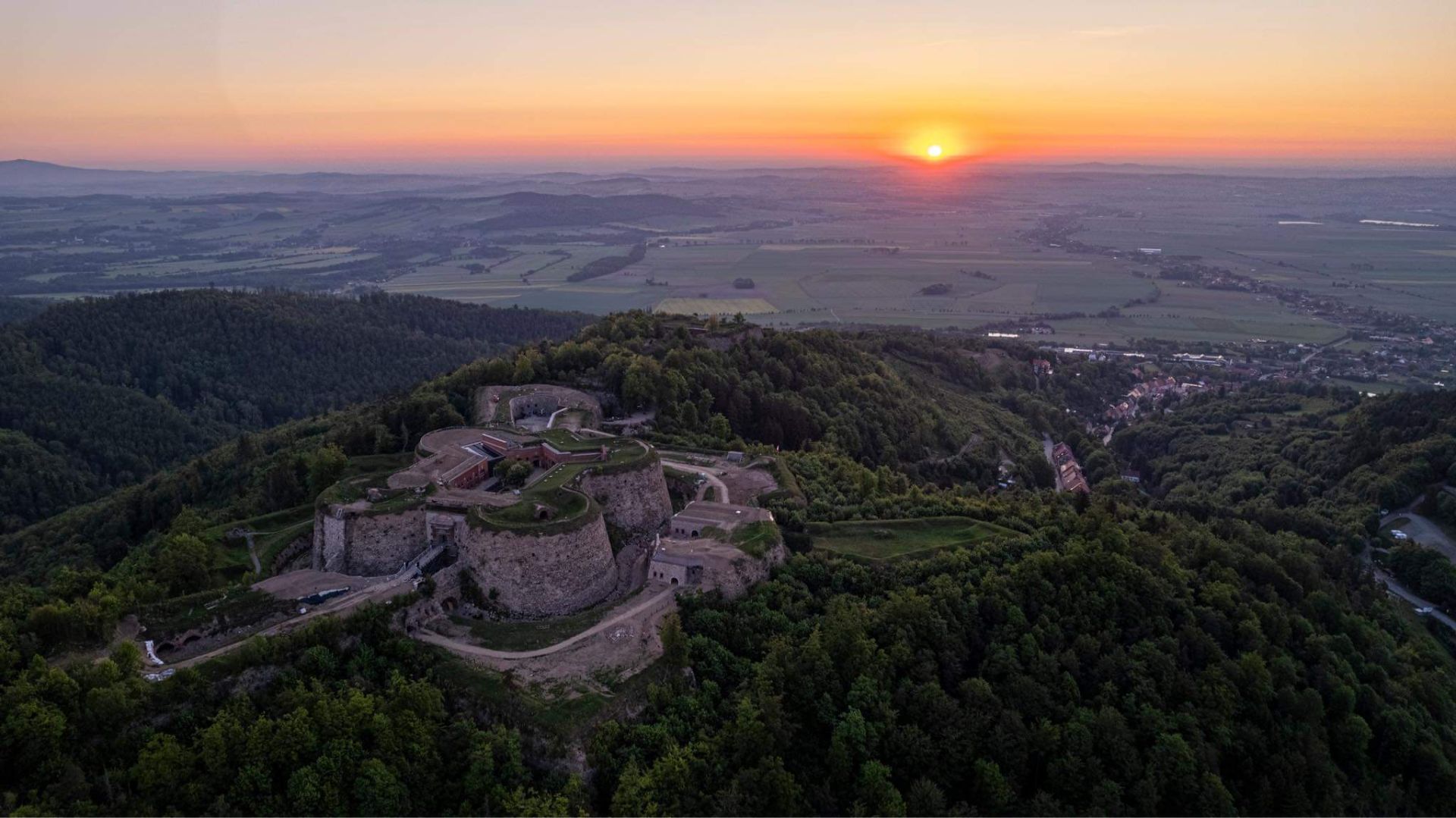
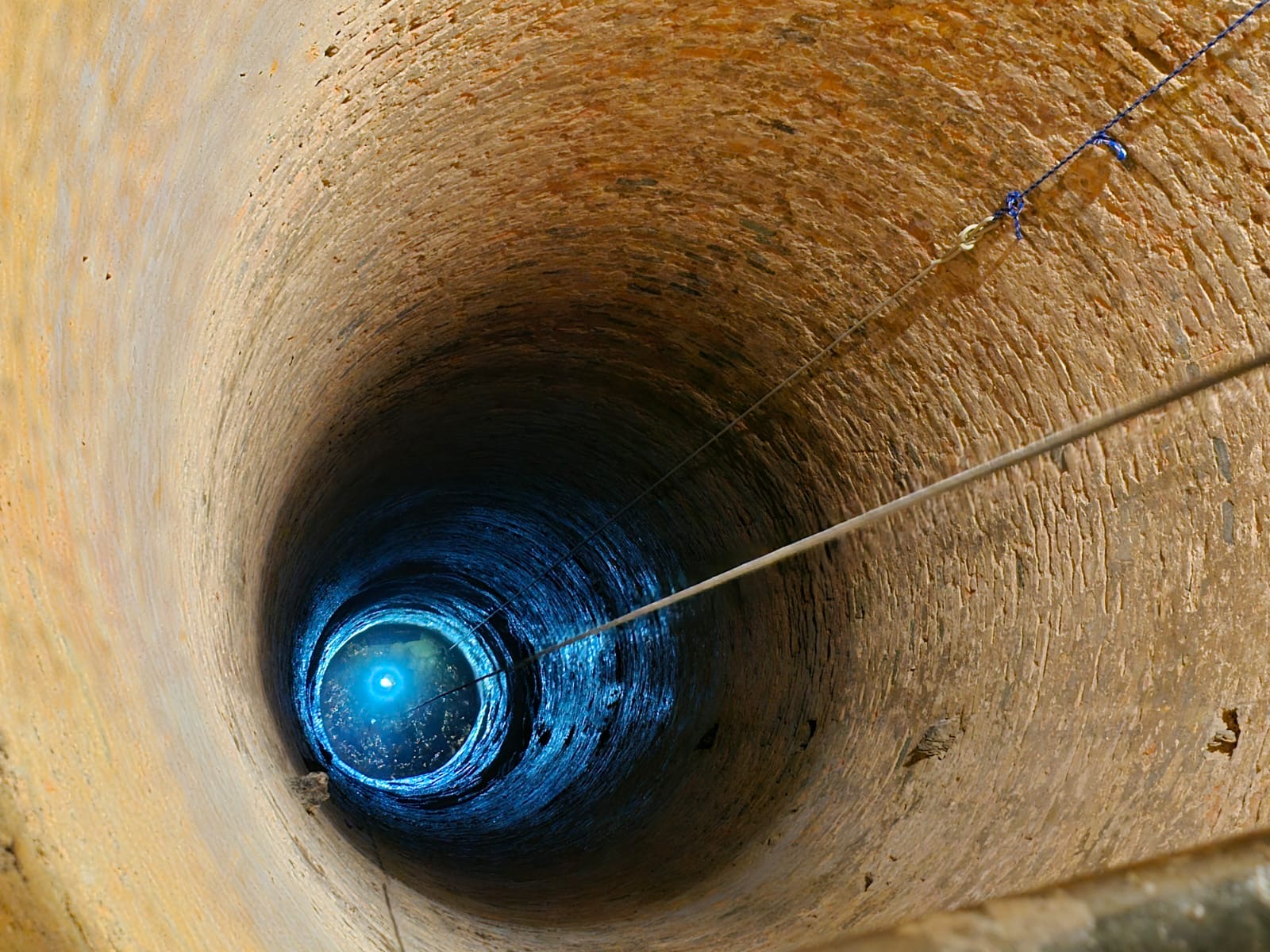
To survive a long siege it needed water, so nine wells were cut through solid rock, some of them 80 metres deep. The diggers managed about 10 centimetres a day. Legend says the wells cost as much as the rest of the fortress.
Some of the wells have side tunnels. Over the centuries the water rose and flooded them. Divers hadn't been inside since the 1980s.
Getting in
Our first requests went nowhere. A few years earlier, a group of divers had gone into one of the wells without asking anyone, and the fortress remembered.
In spring 2023, three other divers and I set up the Submerged Foundation to give our underwater scanning projects a name and a legal form. We went back as a foundation, with the 3D map of the Maria Concordia mine and photogrammetry of flooded Roman ruins in Croatia behind us. This time the answer was yes.
The team: three divers, a surface crew led by Michał Winek, a legend of Polish cave diving, to lower us some 30 metres down each well on ropes, and two people documenting it all. The XDEEP Exploration Support Program backed the project.
The brewery well
On 17 May 2024 we started with the well under the old brewery, in the Nowowiejski Bastion. Old plans showed a tunnel there, partly explored in the 1980s.
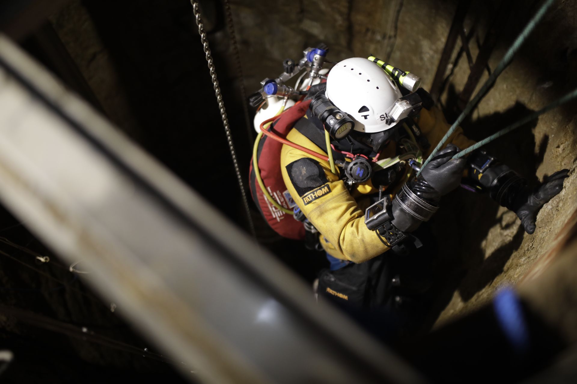
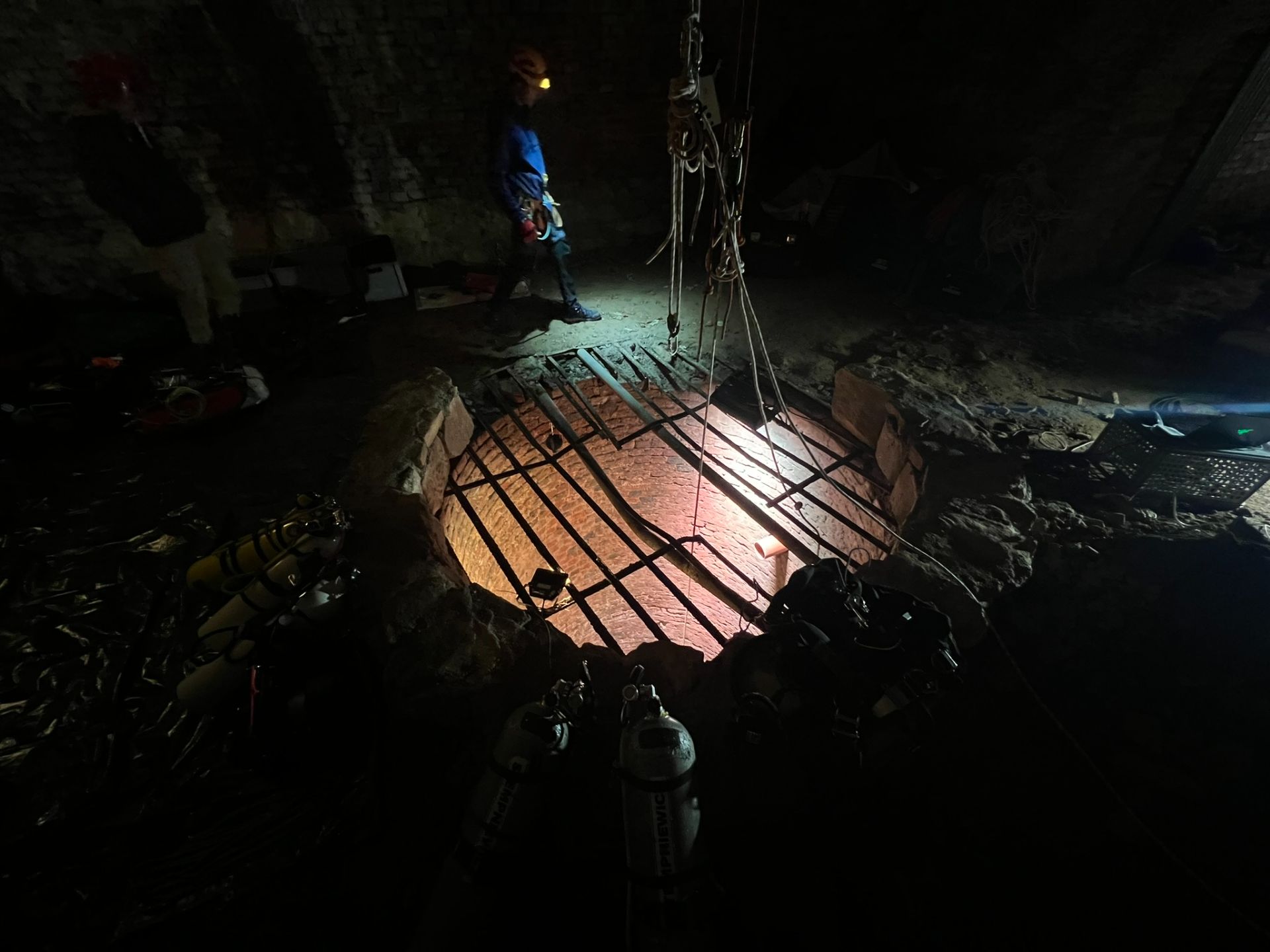
It's a black hole in the floor of a vaulted casemate. Half a metre under the surface, a grate is wedged across the shaft. We squeezed past it, and from then on we knew there was no quick way up.
About 8 metres down, the tunnel leaves the wall. Fifteen minutes of squeezing later I was at the brick corridor from the start of this post. It runs another 6 to 8 metres and ends at a brick wall.
I scanned the end and swam back by touch, in zero visibility, as expected. The tunnel matched the old plans. What it was for, we didn't know yet.
Under the moat
Back on land we studied the maps again. The tunnel kept going: under the moat and beyond, towards a structure on the far side of the fortress.
Getting to that structure was an expedition of its own. Through thick undergrowth, then down a rocky slope on ropes, to a forgotten casemate hidden in the outer wall of the moat. Inside: a narrow square shaft, half full of rubble, nothing like the fortress's other wells.
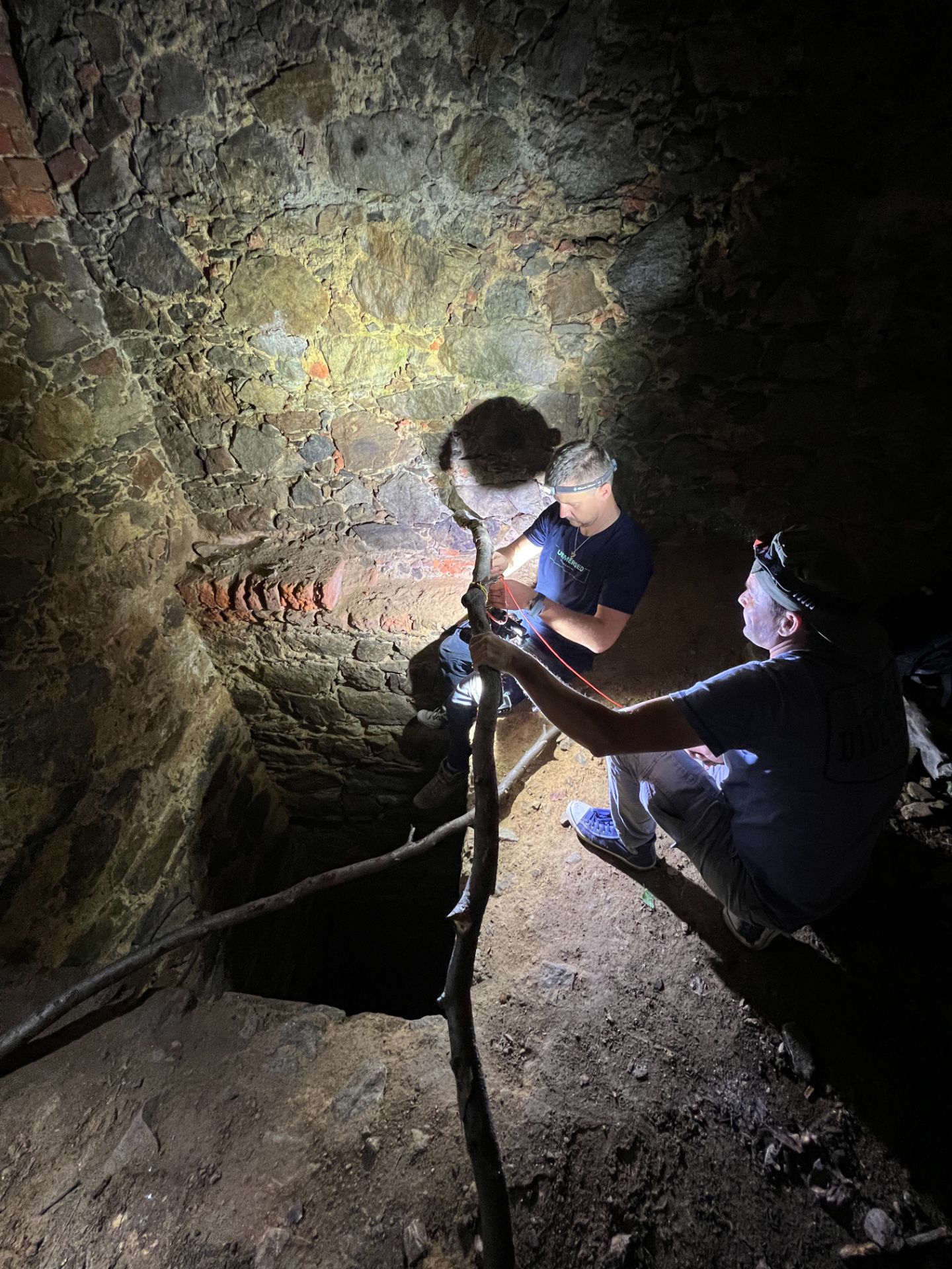
[Image needed: the hidden casemate in the outer wall of the moat, or the ROV going in]
We sent an underwater robot (ROV) into the tunnel, to keep divers out of it. Its cable snagged on old metal, and the scanning mission became a rescue. I was already out of my drysuit, drinking tea and trying to warm up, when I heard I had to go back down the black hole. Why does it always have to be me?
Pumping it dry
After that, diving the tunnel looked like too much risk. So we drained it.
With the fortress's caretaker, Grzegorz Basiński, we brought in a high-capacity pump. First the grate came out of the shaft. Then about 120 cubic metres of water, and the tunnel stood dry for the first time in centuries.
Walking it changed everything. Underwater it had felt twisted like a snake. Dry, it was as straight as a rifle barrel.
There are niches in the walls, probably for oil lamps.
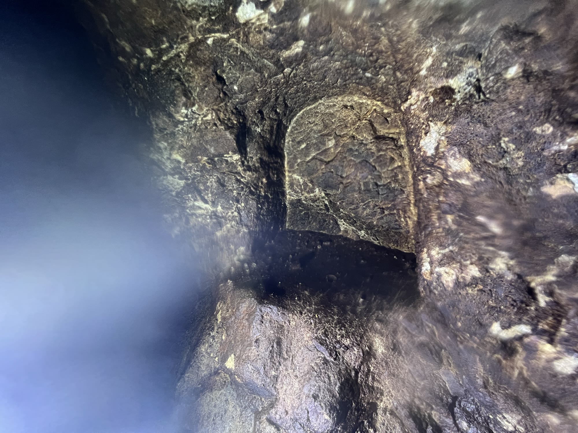
At the end, where I'd seen only brick underwater, a vertical shaft goes up, choked with rubble.
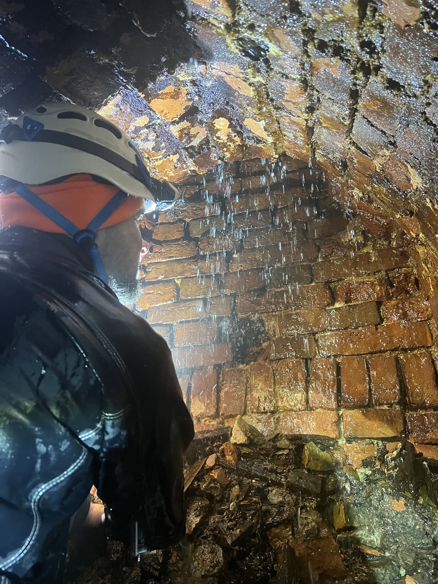
To check where it leads, we played a loudspeaker in the casemate on the far side of the moat and listened at the brewery end. We could hear it clearly.
What's in the scan
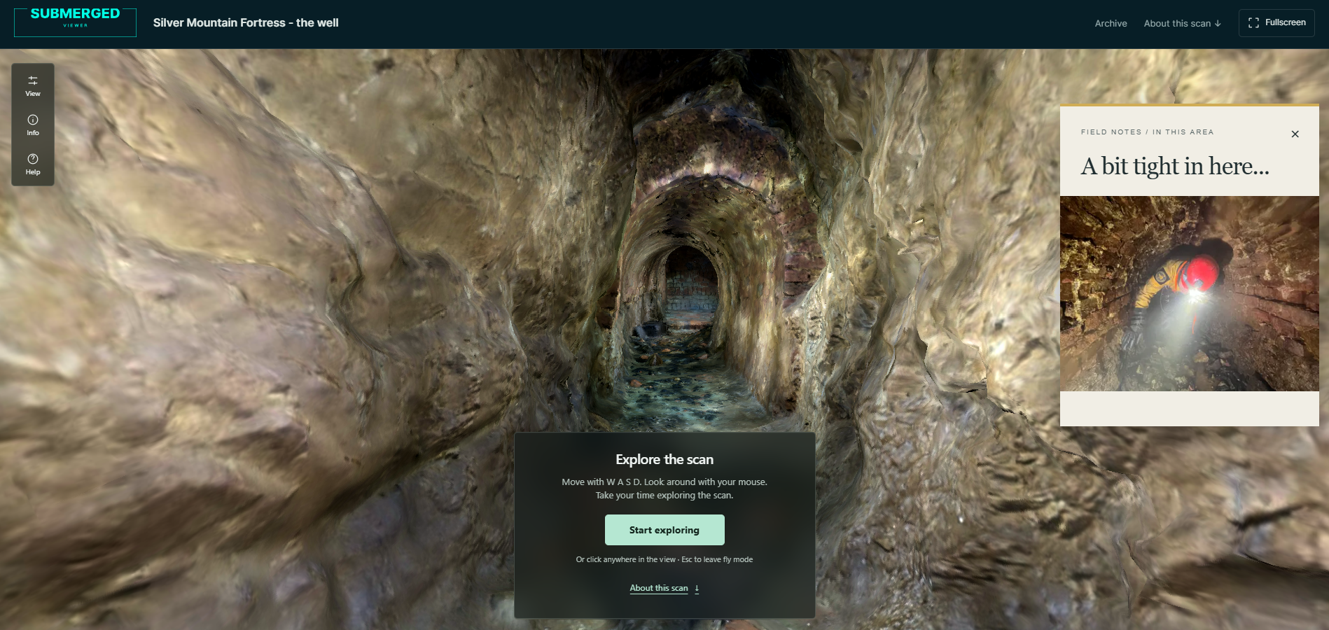
The model shows the well and the drained tunnel: 10.6 million polygons and 6 million vertices, about 409 MB. You don't download it. The viewer streams it as you move.
I've marked the places from this story so you can jump straight to them: Well, Going down, With high water, Corridor Entrance, A bit tight in here..., Candle cavity (one of the lamp niches) and Brick ending.
Move with W A S D and look around with the mouse. The viewer is an experiment, and the first load takes a moment while it fetches the coarse model; the detail fills in as you go. I wrote more about how it works in the Marie Agnes post.
Go inside the Srebrna Góra well scan
Three wells down
In the well under the Donjon, the fortress's central tower, we found no treasure. Just a lost wristwatch. But about 10 metres below the water, carved into the wall, there's the word AWE and what may be Cyrillic letters. We scanned them in 3D and printed scale models for historians to study.
[Image needed: the AWE inscription, from the scan or the 3D print]
So far we've explored three wells and looked into a fourth with a camera. Five are still waiting.
A Submerged Foundation project, supported by the XDEEP Exploration Support Program. Team: Marcin Stempniewicz (lead), Sławek Patuła, Michał "Ciastek" Gurbiel, Michał Antoniuk, Michał Winek, Waldek Jasiński, Sylwia Sierpniowska-Saladyga, Emilia Marczewska, Łukasz "Orzeł" Orlicki, Błażej Kabziński (film), Mateusz Zahora (drone), Ewa Rutkawska, Piotr Gawlas Kudlaty, *Tomasz Grzegrzułka Murzyn.*
Thanks to Grzegorz Basiński of Srebrna Góra Fortress, who made the project possible.
Marcin Stempniewicz
Cave Diving 3D Photogrammetry Instructor · Underwater 3D Academy
Marcin Stempniewicz is a TDI Full Cave diver, technical wreck diver, and 3D artist based in Poznań, Poland. He founded the Submerged Foundation to document underwater environments that almost nobody will ever see in person -flooded mines, caves, and wrecks -and to bring them back to the surface as accurate, explorable 3D models.
His flagship project is the Maria Concordia flooded magnesite mine, supported by the XDEEP Exploration Support Program. Over hundreds of hours underwater, Marcin and his team worked through four labyrinthine levels and a 40-metre vertical shaft in cold, silt-prone, zero-margin conditions, capturing hundreds of thousands of photographs and reconstructing the entire mile-long site as a single coherent model. The same approach has taken him into the Marie Agnes silver-lead-zinc mine—some 12,000 photos over four dives—the Cold War-era Kowary uranium mine, and the flooded galleries of the Srebrna Góra fortress. He also collaborates with Poland's National Maritime Museum on the digital documentation of wrecks, where a cinematic 3D record is often the only form in which a vanishing site can be preserved.
That field experience is where U3DA comes from. Every scan Marcin has ever brought home hit the same wall: the photogrammetry software produces a mesh, and the mesh is not the story. Wrong scale, muddy textures, a viewer that only another specialist can read. The workflows, lighting rigs, shader setups, and Python scripts he built to solve that for his own expeditions became the course. Outside the water, Marcin co-founded Ar-range, a rendering platform that produces every product variant a furniture brand sells—millions of images from one 3D source—and the same batch-rendering and automation discipline runs through the U3DA workflows.
His work has appeared in InDepth (GUE), XDEEP ESP, divers24, and Podcast Spod Wody. He has presented at Hidden Earth (UK), the NSS Convention (West Virginia 2024, Tennessee 2025), Baltictech, and Dive Expo Belgium 2025, on how accurate 3D documentation changes both cartography and dive planning in overhead environments.
"The raw scan is not the product," Marcin says. "The story non-divers can experience is." At U3DA, he teaches divers, wreck surveyors, marine archaeologists, and underwater photographers—starting from zero Blender experience—how to turn their own scans into cinematic animations that a museum, a sponsor, or a family member can actually watch.
Surfaced with a scan the world should see?
U3DA turns your photogrammetry into full-HD renders, cave fly-throughs and finished dive videos in Blender. No 3D background needed. Start with the free first lesson.
Frequently asked questions
Who ran this project?
The Submerged Foundation, a Polish foundation for underwater exploration and 3D scanning projects, with support from the XDEEP Exploration Support Program. Marcin Stempniewicz led the exploration.
Where is Srebrna Góra Fortress?
In the village of Srebrna Góra in Lower Silesia, south-west Poland, south-west of Wrocław. In English it's often called Silver Mountain Fortress.
Can anyone dive the wells at Srebrna Góra?
Only with the fortress management's permission. It's a protected historic monument, and every dive in this project was planned with the management.
How big is the scan, and do I need to install anything?
The model is 10.6 million polygons and about 409 MB. You don't install or download anything: the viewer runs in your browser and streams only the part of the model you're looking at.
What is at the end of the tunnel?
A vertical shaft, choked with rubble. A loudspeaker test showed the tunnel connects the brewery well with a casemate on the far side of the moat.
Is this the whole well system?
No. It's one well and its tunnel. The fortress has nine wells; three have been explored so far.