 Underwater 3D Animation for Divers
How to 3D Scan an Underwater Cave
A cave diver's field guide to underwater photogrammetry: why you scan, the boom rig, the overlap rule, the surface team and the real numbers from the Maria Concordia mine.
TL;DR
Decide why you are scanning. What do you want to do with? Long story short - just simply make sure photogrammetry is exactly what you're looking for. Then prepare yourself for a bunch of surprises outlined below. Some of the risks you can minimize, while so of them you just have to prepare for. Also keep in mind that getting into the water and capturing the photo data is just the beginning of your story.
Every few weeks someone writes to me with the same question: "I dive caves. I want to scan them. Where do I start?" Well, the scanning itself is the easy part. Reconstruction and presenting it to broader audience is where it becomes more tricky.
Here is how we did it in the flooded Maria Concordia mine in Poland: what worked, what broke, and what I would tell you to do first.
Start with why, not with the camera
Photogrammetry is a tool, not a goal. Before you plan a single dive, answer two questions: why am I scanning this place and what will I find there?
- A map. If the site is a mine with long, straight corridors, a 3D scan is the wrong tool. A laser distance meter, a compass and a wet notebook give you a better map in a fraction of the time. Scanning earns its keep on irregular shapes: caves, collapses, restrictions, shafts.
- Safety. A model that divers can "swim" before the dive removes one stress factor from an unknown site. Mikko Paasi told me about a restriction in Tham Luang, during the rescue, that the team squeezed through blind. When the water dropped it turned out to be a keyhole. The line ran through the narrow part.
- Change over time. Glacial caves and wrecks change from year to year. A scan repeated on a schedule becomes a measurement, not just a picture.
If your answer is "because it's cool", that is fine too. Actually that would be my answer in most cases. Just know that it decides everything downstream: resolution, coverage, how many dives, how many batteries.
*Disclaimer, so you don't say I'm a terrible person: Be a cave diver first, a scanner second
Scanning an overhead environment takes all of your attention. Gas checks, buoyancy, line awareness and light management have to run on autopilot, because the camera rig will take the rest. My own path was about five years from recreational diver to full cave, and another three years before my first mine scanning project. I am glad I gave myself that time.
Two things will end a scanning dive early if you are not ready for them:
- Silt. In Maria Concordia the sediment is so fine that the water moved by a passing diver lifts it. Add regulator bubbles knocking particles off the ceiling, and you must assume the way back will be in zero visibility.
- Cold. The water is 8 °C. Two of our four divers found drysuit leaks on the first day. Spare suits saved the project.
If you are not cave certified, you don't have to wait until you are. Spend this time wisely, by simply practicing in dry sites first: caves, bunkers, old fortifications. A phone and open-source software are enough to learn the craft.
And when the time comes, you'll be ready for the fun part.
The rig: a boom, not a handheld camera
The first thing I learned, on a small test site called Marie Agnes (under 100 m of flooded corridor), is that holding the camera in front of you the way an underwater photographer does simply does not work. You cannot sweep a corridor cross-section from your hands.
What works:
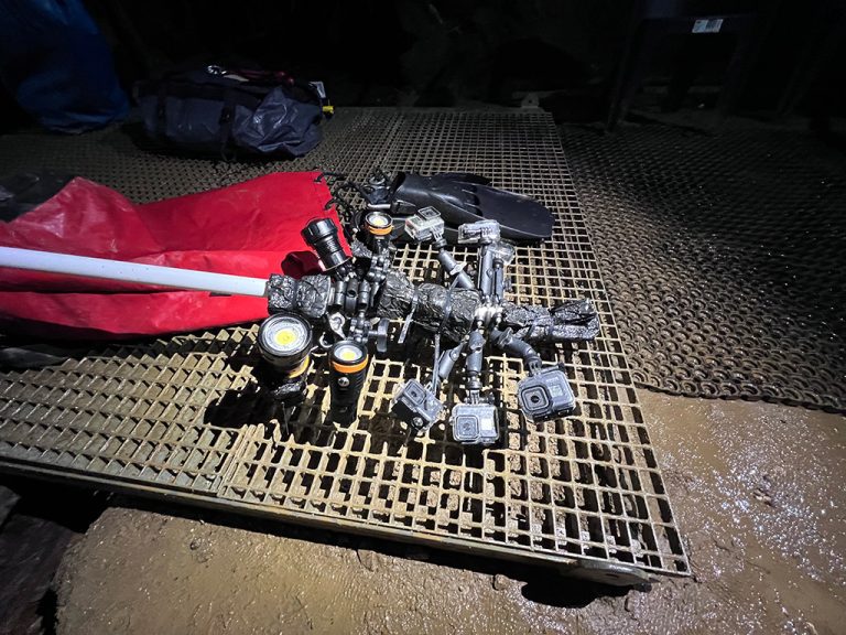
- A 1.5 m boom with the camera and a single wide-angle video light at the end.
- Balanced to neutral with foam, so the whole set weighs nothing in the water.
- The camera always perpendicular to the surface you are photographing. Without moving your body you can trace a full circle around the corridor and cover walls, ceiling and floor.
- A bonus: the camera sits ahead of you, in clearer water, before your fins stir anything up.
For Maria Concordia we needed faster coverage, so the boom carried five GoPro cameras, angled so that each field of view overlapped the next by about 50%. Shooting one frame per second, the set captured roughly half the corridor cross-section every second. Lighting came from four wide-angle video lights.
Overlap is the whole game
Photogrammetry software builds the model by finding the same points in many photos. If a patch of wall appears in only one frame, it does not exist. The rule on every dive: every part of the wall, ceiling and floor must appear in several shots, from slightly different positions. Move slowly, keep the distance to the wall steady, and never swing the rig faster than the light can follow.
The problem is not taking photos. It is knowing what you have already covered. A a mile of corridor looks the same after the fourth pass. We kept a working map on the surface, marked each scanned section after every dive, and briefed the next diver from it. Systematics beats heroics.
The surface team runs the show
Here are the numbers from our first two and a half days in Maria Concordia. They explain why this is not a one-person project:
- 4 cave divers, 2 people on surface support, 2 photogrammetry and 3D specialists
- 5 cameras and 4 lights, with 3 full battery sets for each
- 48 light batteries and 15 camera batteries in rotation
- 6 scanning dives a day
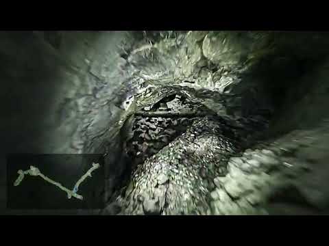
- about 110,000 photos across 4 flooded levels
After each dive the rig went straight to the surface team: batteries swapped, cards copied to disk, a fresh set handed to the next diver already waiting in the water. One detail that matters: the "dry" chamber at the bottom of the 40 m shaft is so humid that we never opened a camera housing down there. Moisture trapped inside a GoPro case condenses in 8 °C water and fogs the lens from the inside. Every battery change happened topside.
The logistics are way more simple if instead of traditional cameras, you use a single or double 360 camera. I'll be describing this workflow in another article.
Plan B, C and D
Cave training teaches you to carry a backup for everything. Scanning projects need the same mindset. Before the first dive we had lost our underwater photographer to illness, several memory cards refused to work with the rented cameras, and one camera died without explanation. We bought cards on the way, reconfigured the rig around the cameras that worked, and rescheduled the photo session for a later trip. None of it was dramatic, because none of it was a surprise.
What happens after the dive
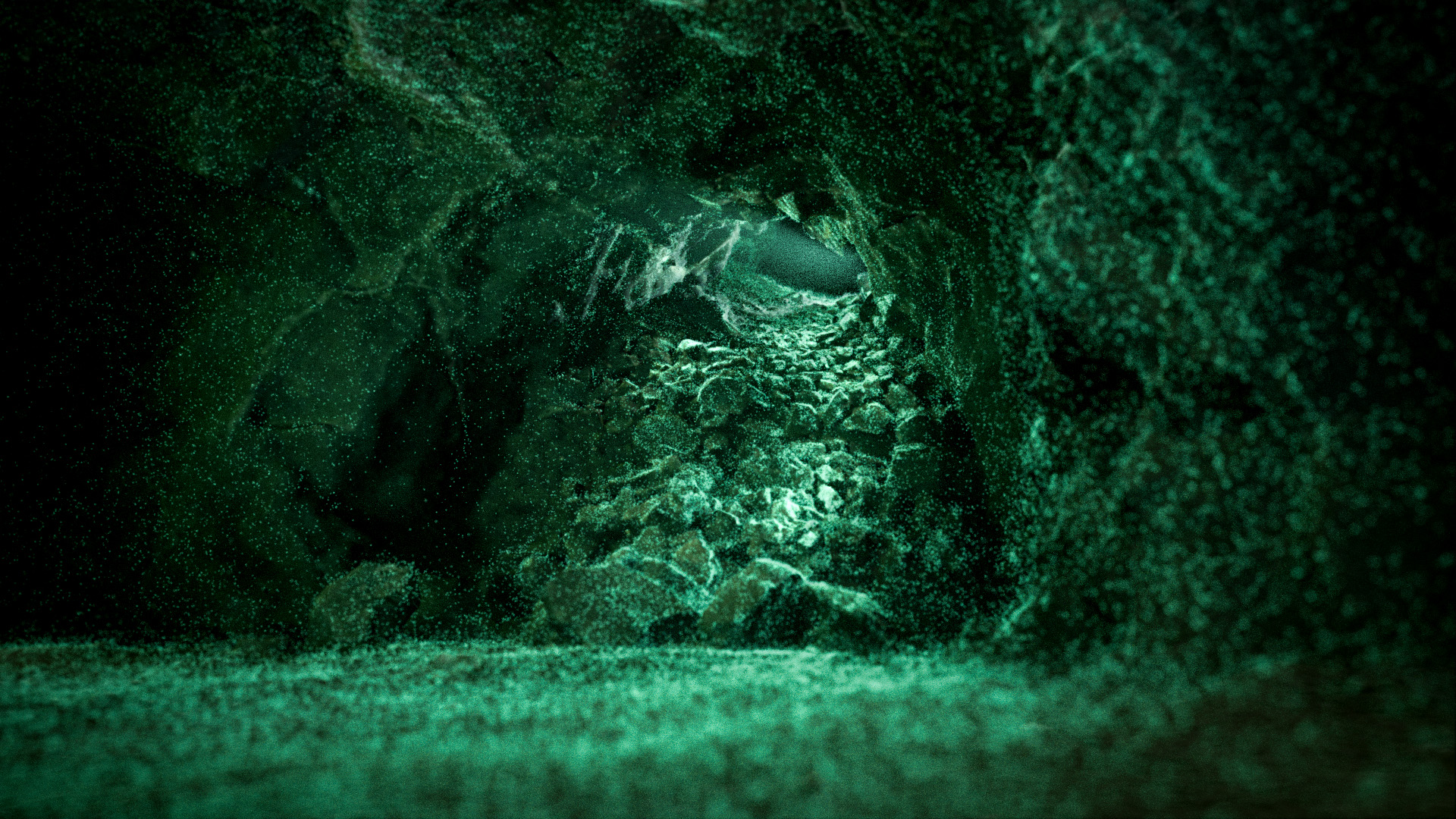
Processing the material from that first trip took well over a month of computer time. Then came the part nobody warns you about: a raw 3D model is not a story. Nobody outside cave diving will look at a point cloud for more than ten seconds.
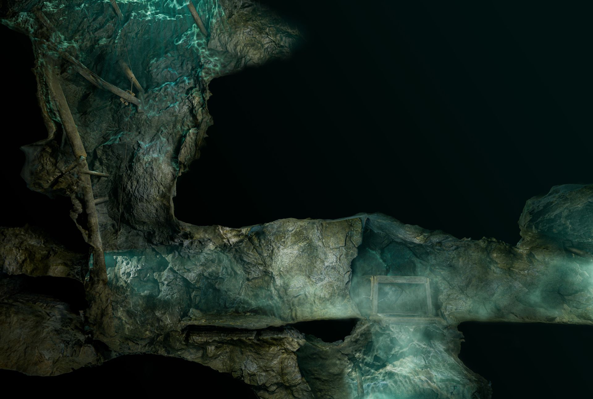
What people did look at were the cross-sections: the mine sliced open, magnesite veins on the walls, the remains of scaffolding and winches still in place. Then the fly-throughs, then the VR experiments. The scan was the beginning of the project, not the end.
That is exactly the gap U3DA exists to close. You already know how to plan the dive and run the camera. The course takes the model you bring up and turns it into renders, cave fly-throughs and finished dive videos in Blender, using the workflows from these same projects. The first lesson is free.
Further reading: my full account in InDepth magazine, the Maria Concordia project at the Submerged Foundation, and the XDEEP Exploration Support Program project page and field story.
Marcin Stempniewicz
Underwater 3D instructor · Underwater 3D Academy
Marcin Stempniewicz is a TDI Full Cave diver, technical wreck diver, and 3D artist based in Poznań, Poland. He founded the Submerged Foundation to document underwater environments that almost nobody will ever see in person -flooded mines, caves, and wrecks -and to bring them back to the surface as accurate, explorable 3D models.
His flagship project is the Maria Concordia flooded magnesite mine, supported by the XDEEP Exploration Support Program. Over hundreds of hours underwater, Marcin and his team worked through four labyrinthine levels and a 40-metre vertical shaft in cold, silt-prone, zero-margin conditions, capturing hundreds of thousands of photographs and reconstructing the entire mile-long site as a single coherent model. The same approach has taken him into the Marie Agnes silver-lead-zinc mine—some 12,000 photos over four dives—the Cold War-era Kowary uranium mine, and the flooded galleries of the Srebrna Góra fortress. He also collaborates with Poland's National Maritime Museum on the digital documentation of wrecks, where a cinematic 3D record is often the only form in which a vanishing site can be preserved.
That field experience is where U3DA comes from. Every scan Marcin has ever brought home hit the same wall: the photogrammetry software produces a mesh, and the mesh is not the story. Wrong scale, muddy textures, a viewer that only another specialist can read. The workflows, lighting rigs, shader setups, and Python scripts he built to solve that for his own expeditions became the course. Outside the water, Marcin co-founded Ar-range, a rendering platform that produces every product variant a furniture brand sells—millions of images from one 3D source—and the same batch-rendering and automation discipline runs through the U3DA workflows.
His work has appeared in InDepth (GUE), XDEEP ESP, divers24, and Podcast Spod Wody. He has presented at Hidden Earth (UK), the NSS Convention (West Virginia 2024, Tennessee 2025), Baltictech, and Dive Expo Belgium 2025, on how accurate 3D documentation changes both cartography and dive planning in overhead environments.
"The raw scan is not the product," Marcin says. "The story non-divers can experience is." At U3DA, he teaches divers, wreck surveyors, marine archaeologists, and underwater photographers—starting from zero Blender experience—how to turn their own scans into cinematic animations that a museum, a sponsor, or a family member can actually watch.
Surfaced with a scan the world should see?
U3DA turns your photogrammetry into full-HD renders, cave fly-throughs and finished dive videos in Blender. No 3D background needed. Start with the free first lesson.
Frequently asked questions
What equipment do you need to 3D scan an underwater cave?
A cave-diving configuration you operate on autopilot, plus a camera rig: action cameras and wide-angle video lights mounted on a boom about 1.5 m long, balanced to neutral buoyancy with foam. For the Maria Concordia mine we used five GoPro cameras and four video lights with three full battery sets each, and spare memory cards. Photogrammetry software such as Metashape builds the model afterwards.
How much overlap do the photos need for cave photogrammetry?
Every part of the wall, ceiling and floor must appear in several photos taken from slightly different positions; a surface that shows up in only one frame will not be reconstructed. On our multi-camera boom, neighbouring cameras overlapped by about 50% and shot one frame per second while the diver moved slowly along the corridor.
Can I scan a cave with a phone and free software?
Yes, for dry caves, bunkers and fortifications: a phone, a good light and open-source photogrammetry software are enough to learn the craft. Underwater scanning in an overhead environment requires full cave training first. Without it you will not get a usable result and you are likely to get hurt.
How long does it take to process an underwater cave scan?
It depends on the photo count and your computer. The roughly 110,000 photos from the Maria Concordia mine took well over a month to process into 3D models of the four flooded levels, followed by weeks of work on cross-sections, fly-throughs and other visualisations.
Why scan a flooded mine or cave at all?
Three reasons: mapping irregular spaces that a compass and distance meter capture poorly, letting divers familiarise themselves with a site before the dive, and measuring change over time in places like glacial caves or degrading wrecks. The scan is also the raw material for renders, fly-throughs and films that show the place to people who will never dive it.
What are the best methods for underwater cave mapping?
Photogrammetry is by far the most popular and accessible for recreational and professional cave scanning as of 2026. Worth remembering that cave scanning requires either a rig of multiple (3 or more) action cameras or on high resolution 360 camera for optimal coverage. Light setup of above 50.000 lm is highly recommended.